Last check: 06/27/2026 Slap count: 4 Last checked ID: 16777215
22 April 2020 - map update
1
There has been a period since beginning of this year, when the English
page of the
mapywig.orgg has not been updated at all, while, in the meantime, we
have
added quite a few new maps. So, to catch up...
3. Literature
- also from the collection of the Library of Congress:
- a few editions of the MITTEILUNGEN des Reichsamt für Landesaufnahme
dated 1939 - 1943.
- a few brochures dated 1943/44, prepared for the eventuality of
Allied's invation / landing in the Balkans (Yugoslavia and Albnia),
- „Militärgeographische Angaben über Finnland” dated 1941, already
mentioned above
5. From McMaster University, Canada,
jointly scanned by The University of Alberta,
and originally most sheets from the collection of prof. Bogdan
Zaborski. Some more information about him - in Polish) can be found in
this PDF,
courtesy of the przez Faculty of Geography and Regional Studies,
University of Warsaw.
- approx.
400 sheets of the Topographische Karte (Messtischblatt) from the area
of western and central-north Poland, plus approx. 130 sheets from our
own collection
- approx. 1500 sheets,
British, American (and several French), covering the area of
Germany within post-WW2 borders.
Older edition, dated 1943 - 1944 are re-printed copies of, sometimes,
rather old editions of German Topographische Karte (Messtischblatt).
From 1944 onwards, most editions were updated from air photography. The
series is called, interchangably (sometimes) as GSGS 4414, and AMS M
841, elsewhere GSGS 4414 (AMS M841) or AMS M841 (GSGS 4414). Several
sheets prepared for and / or published by the French Service
Géographique des Forces Françaises
en Allemagn. Later, post-WW2 editions produced under the BAOR (British
Army of the Rhine), although the bulk of the sheets are the work of
AMS, for USAREUR (United States Army Europe).
In time, also (west) German istitutions participated in the series,
particularly the Land Survey Offfice (LSO) based in Frankfurt a.M.,
later incorporated into the Instituts für Erdmessung (Institute for
Geodesy).
Several new items in the Literature section,
most importantly, German Military topography journals from 1942 -
Mitteilungen des Chef des Kriegskarten und Vermessungswesens. The set
is incomplete, but as usual, we will try to locate missing issues and
index sheets
Mapa
Rzeczypospolitej Polskiej i Krajów Ościennych (Map of the Republic of
Poland & Neighouring Coutries) in several sheets of 1:750,000
scale, published by WIG in mid-1920. This "edition", dated approx. 1924
is incomplete (missing Eastern Poland), glued together sklejone of
several individual sheets based on the original, Austrian 1:750,000
maps. As the 600 dpi
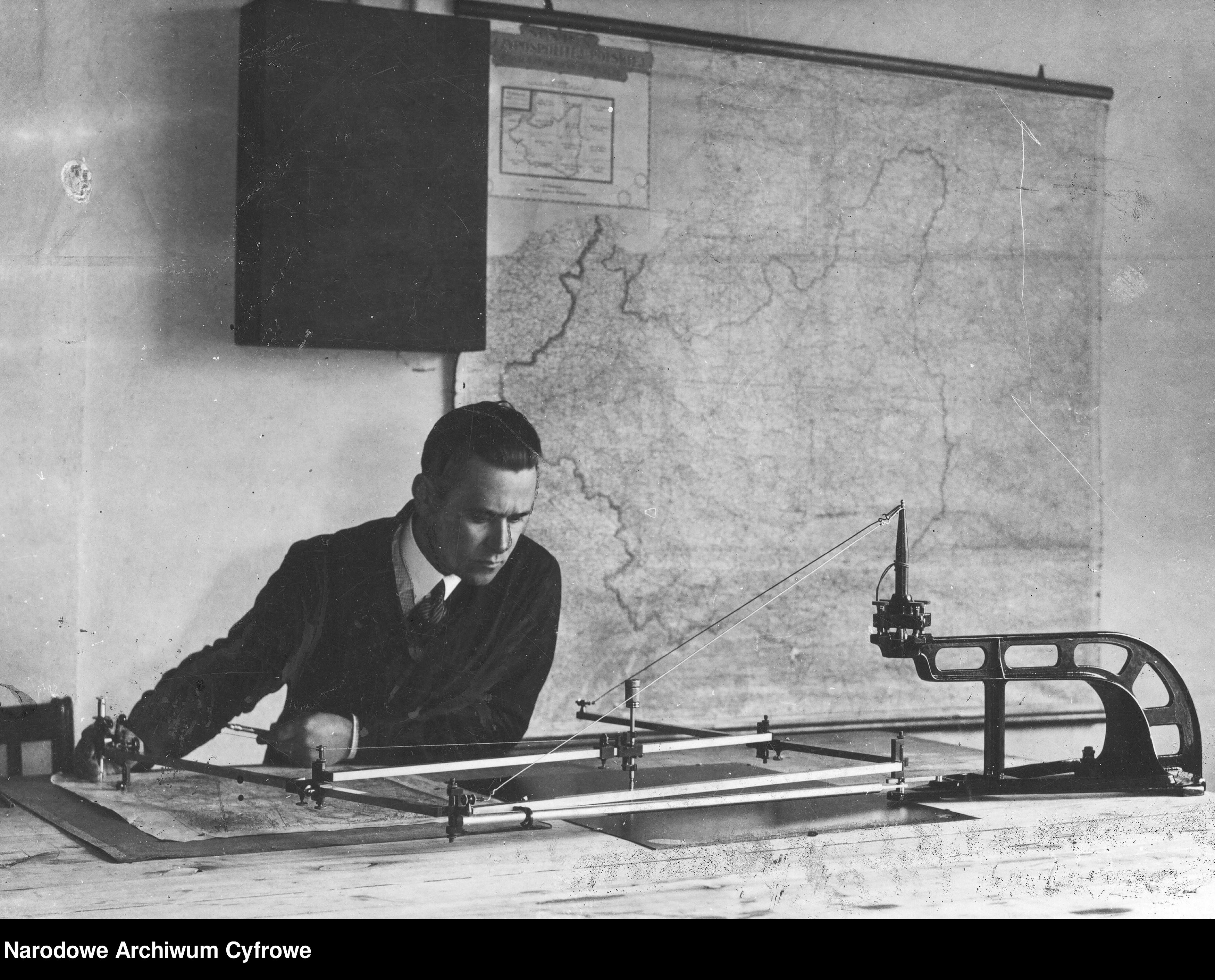
is large, approx. 120 Mb, we've made it available in 300 dpi too. And what the full,
wall-sized variant looked like, can be seen on a photo fished out of the Poland's National
Digital Archive. few other
WIG-related photos can be seen here.
A German "MAP OF RAILROADS and steamships in EUROPE" dated
approx. 1870: "EISENBAHN-Dampfschiffrouten-Karte von EUROPA". The map
was known and republished many times over well into 20th century. This
edition howeve is substantially larger (180 cm x 137
cm), good enough for a photo-wallpaper. 600 dpi file is approx. 215 Mb,
so we have also made available a more reasonable 300 dpi (80 Mb),
and for those who just want to appreciate the looks, a 100
dpi variant (7.6 Mb), which should open in most, if not all
web browsers).
We have also added several dozen original index sheets, which
correspond to various map series. As there are hundreds, perhaps
thousands of index sheets floating around, there is no space to list
those added here. They can be found at the bottom of individual index
sheets, e.g. WIG 1:100 000, as well as at the
bottom of map lists, e.g. WIG 1:25,000, old edition. More
index sheets will be added within the next couple of weeks.
eLiterature
Several new items in the "Literature” section: in Polish:
Courtesy of Mr Grzegorz Słomczyński, a paper by his grandfather, a
known WIG cartographer, written in Italy, approx. 1945r.: J.
Słomczyński „Rzuty Kartograficzne” (PDF), (DOC)
[Cartographic projections]
After a 7-month-short break, a new update:
- from the collection of the Library of Congress, Washington, approx.
800 sheets of the German map of Western Russia, 1:25,000
dating back to WW1. Majority of new sheets covers central
Poland. We do not expect to fill in gaps soon, unfortunately libraries
in Germany, like Herder Institut or Staatsbibliothek zu Berlin do not
allow their maps to be scanned and shared online. That said, we will
try to source those sheets elsewhere.
- from the collection of the State Archive in Poznań, Poland, 50 sheets
of the the1:126,000 Topograficzna Karta Królestwa Polskiego
(also known as Mapa Kwatermistrzostwa). The edition comes
from approx. 1860s.
We have filled some gaps:
- approx.. 50 German 1:25,000 maps of Western Russia
(approx. 1915 - 1918), mainly "Gruppe Krzemieniec", from the collection
of the Library of Congress, USA. We hope to be able to scan some more
sheets of this map type (Gruppe Warschau) next year.
- Courtesy of the Poznan State Archive, Poland, we have added several
sheets of the German Uebersichtskarte von Mitteleuropa,
road map variant (Strassenkarte) and soil types (Bodenarten), as well
as a complete set (39 sheets) of the 1939 German "Gemeindegrenzkarte
des ehemaligen polnischen Staates" (Map of the municipal boundaries of
the former Polish state"). It is a copy, to some degree of a 1937
Polish Administrative Map of Poland, but here, for the background,
German Uebersichtskarte von Mitteleuropa, rather than 1:300,00 WIG
maps, was used. The sheet numbering is in dual (Polish and German)
format.
[From our own collections]:
- several small-scale German maps dated 1941
covering the area of (Europan) Soviet Union. Please note some files are
up to 80 Mb!
- British maps from the Middle East / Persian
Gulf, including a, somewhat bizarre in the current political
climate, map for a proposed route of a Haifa - Bagdad railway.
- a few sheets of an American (AMS M5928)
road maps of Italy Włoch dated 1943
We have also managed to process two more Mil-Geo brochure (Mil-geo
Einzelangaben für die Trupperführung zum Einheitsblatt...) from the Library of Congress collection.
This time the brochures in pdf format are for the Grossblatt No 66 (Frankfurt
a.d. Oder - Kuestrin - Landsberg a.d. Warthe - Zielenzig)
and No 67 (Meseritz -
Birnbaum). The brochures should those interested in
industrial history of the area (bridges!), although some scans' quality
suffers, because the two volumes were bound very tightly.
Another update can be expected around the turn of October / November.
A map update:
- with kind permission of the Institute of Geography and Regional
Development, University of Wrocław, we've managed to scan 9 rare sheets
of WIG 1:25,000 maps
- Another interesting set includes five WIG index sheets for the 1:25,000
maps, dated 1935 - 1939. They were originally published in
the "Secret Gazette of Ministery of Military Affairs' Orders", which
were made available by extremely helpful staff at the Warsaw Museum of
the Polish Army.
The index sheets can be found below the Mapster index for the WIG
1:25,000 scale map set - see the last 5 index sheets on the list there.
- Several rare German 1:25,000 photomaps (Bildplan / Bildskizze), which
we managed to locate in the (previously scanned) collection of the
Faculty of Geographical & Geological Sciences of the Poznań
University. Some sheets are cut alongWIG 1:25,000 lines,
others identical to the German Messtischblatt / Topographische Karte
layout
- Also, courtesy of the same university some 70 sheets of the German
1:25,000 geological map (some sheets cover the area of western Poland,
while the majority, the terriotory of Germany).
All new scans are available in 600 dpi.
A new update is planned for the turn of September / October.
1
Courtesy of the Library of Congress, we have added approx. 2250 sheets
of a German WW1 1:25,000
map of western Russia, which covers central
and eastern Poland, as well as Lithuania, Belarus and Ukraine. Majority
of sheets at 400 dpi, the re-scaled Russian 1:84,000 maps (two-verst)
have been scanned at 300 dpi, and a few more interesting sheets, such
as this one
- at 600 dpi.
In a few weeks we should be able to add a few sheets of "Gruppe
Grodno", currently missing, and at least several sheets from the
south-eastern "Gruppe Kamieniec".
The last batch of the maps in the US collections, approx. 300 - 500
sheets from central Poland (Gruppe Warschau), should, if all goes well,
be scanned by the end of spring next year. Filling in blanks after that
might prove difficult and / or time-consuming, as the maps are held by
a few leading European libraries which are famous for guarding jelously
their collections.
A new update should appear within the next couple of weeks.
Hey, Marek! Trying to access maps at your page "Other Central European Maps, via both Chrome and Opera browsers, I get the dialog box "File not found (404 error)
If you think what you'r
Hello: I do Polish Genealogy. I need a topo map of Poland with major cities which I’ve never been able to find on the WEB. It should show post partition Poland with an out line of pre-partition Pola
Hi:
Are there any other maps showing parishes such as:
Andrzej Tomczak
Siec parafialna
Wojewoddztwa pomorskiego
Okregu bytowskiego I leborskiego
W drugiej polowie xvi wieku
Skala 1:300.
Thanks


