Last check: 06/27/2026 Slap count: 4 Last checked ID: 16777215
31st December 2019 - last update
nowosci
(this year):
Several new items in the Literature section,
most importantly, German Military topography journals from 1942 -
Mitteilungen des Chef des Kriegskarten und Vermessungswesens. The set
is incomplete, but as usual, we will try to locate missing issues and
index sheets
Mapa
Rzeczypospolitej Polskiej i Krajów Ościennych (Map of the Republic of
Poland & Neighouring Coutries) in several sheets of 1:750,000
scale, published by WIG in mid-1920. This "edition", dated approx. 1924
is incomplete (missing Eastern Poland), glued together sklejone of
several individual sheets based on the original, Austrian 1:750,000
maps. As the 600 dpi
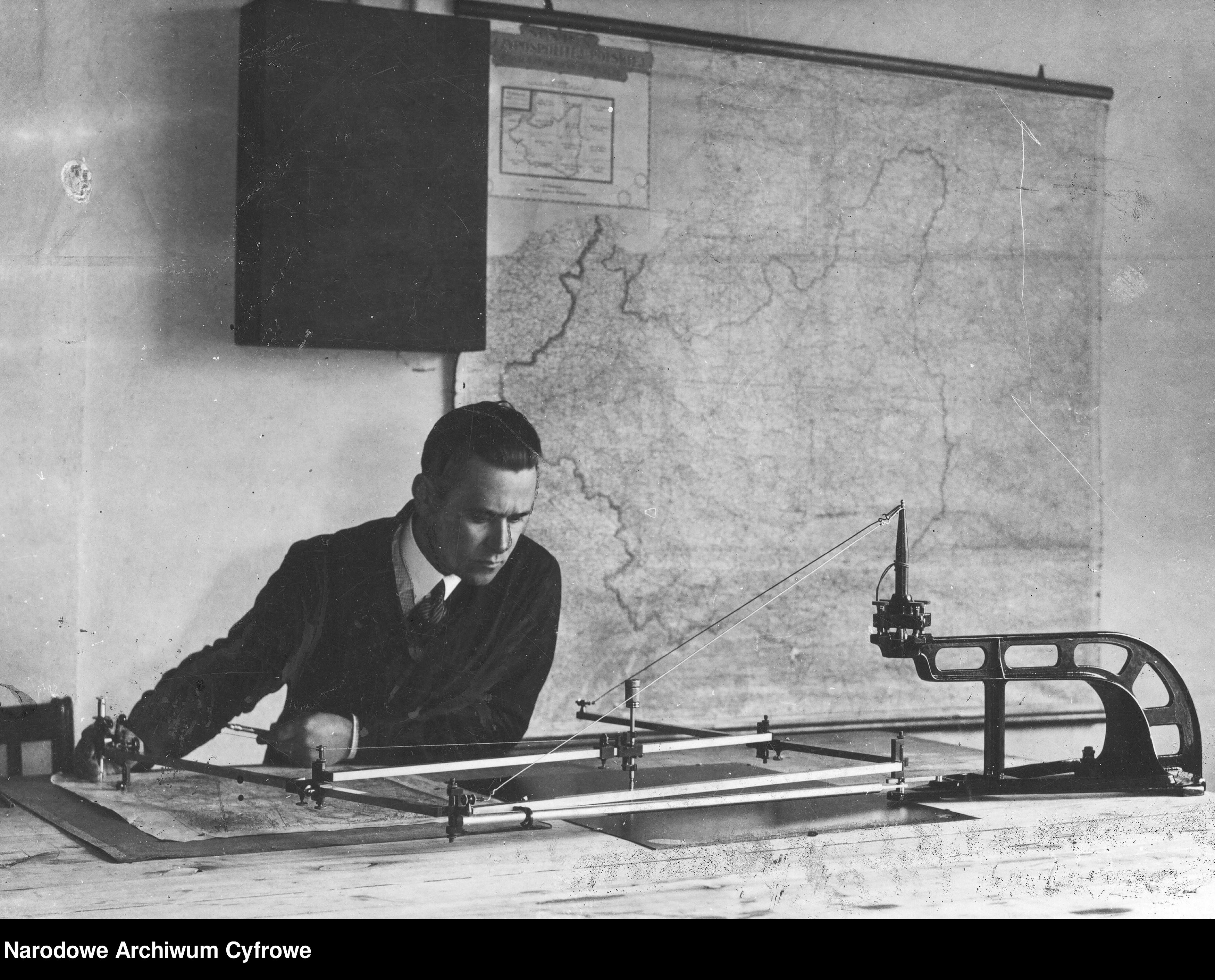
is large, approx. 120 Mb, we've made it available in 300 dpi too. And what the full,
wall-sized variant looked like, can be seen on a photo fished out of the Poland's National
Digital Archive. few other
WIG-related photos can be seen here.
A German "MAP OF RAILROADS and steamships in EUROPE" dated
approx. 1870: "EISENBAHN-Dampfschiffrouten-Karte von EUROPA". The map
was known and republished many times over well into 20th century. This
edition howeve is substantially larger (180 cm x 137
cm), good enough for a photo-wallpaper. 600 dpi file is approx. 215 Mb,
so we have also made available a more reasonable 300 dpi (80 Mb),
and for those who just want to appreciate the looks, a 100
dpi variant (7.6 Mb), which should open in most, if not all
web browsers).
We have also added several dozen original index sheets, which
correspond to various map series. As there are hundreds, perhaps
thousands of index sheets floating around, there is no space to list
those added here. They can be found at the bottom of individual index
sheets, e.g. WIG 1:100 000, as well as at the
bottom of map lists, e.g. WIG 1:25,000, old edition. More
index sheets will be added within the next couple of weeks.
Hey, Marek! Trying to access maps at your page "Other Central European Maps, via both Chrome and Opera browsers, I get the dialog box "File not found (404 error)
If you think what you'r
Hello: I do Polish Genealogy. I need a topo map of Poland with major cities which I’ve never been able to find on the WEB. It should show post partition Poland with an out line of pre-partition Pola
Hi:
Are there any other maps showing parishes such as:
Andrzej Tomczak
Siec parafialna
Wojewoddztwa pomorskiego
Okregu bytowskiego I leborskiego
W drugiej polowie xvi wieku
Skala 1:300.
Thanks


