1
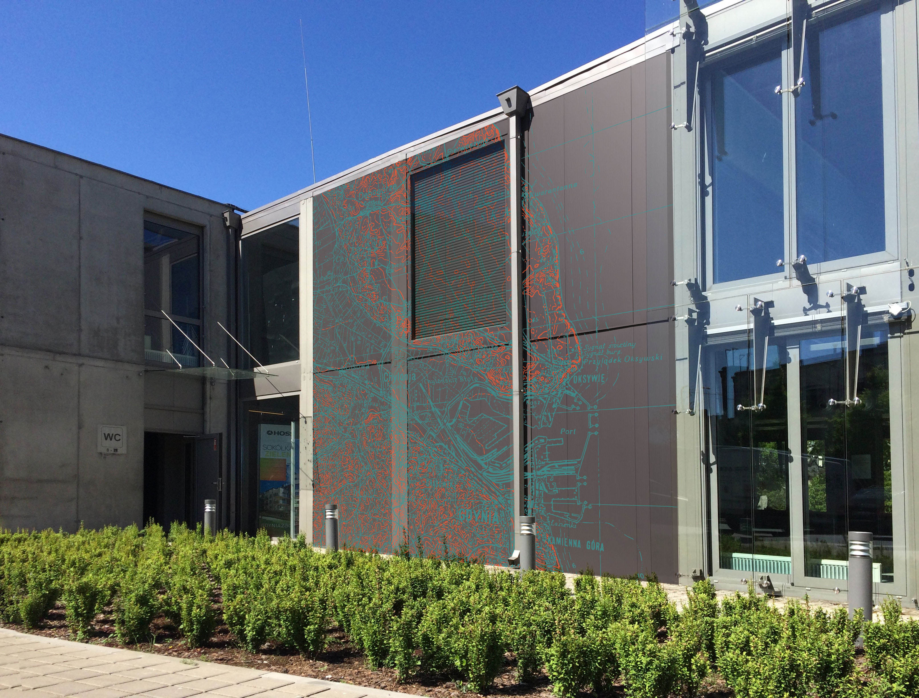
The scans of maps we share are often
used in research papers, internet, or exhibitions. Once in a while
though, you can come across something... unorthodox, such as this application,
found in the Infobox, Gdynia, Poland, by Łukasz Kaczmarek of Pracownia 63A design
studio).
New items:
- from the collection of Mr Ryszard Hubisz: a very large town
plan of Kiew (this time, of German origin, dated 1943). It
is a secret (geheim) variant of the "Sonderausgabe" of the plan
we already have, but the "secret"
variant comes with "enhanced" information, showing additional
buildings, detailed railway infrastructure, etc.
- from the vast collection of the Library of Congress: approx. 500 sheets
of the Soviet 1:25,000 maps dated 1939 - 1940. They are
re-scaled and unrevised reprints of earlier, Tsarist maps, both
half-versts (1:21,000) and verst (1:42,000) editions from the turn of
19th and 20th century. Exact survey dates can be found in top-left
corner and this is how the situation on actual sheets should be dated. The map series covers a large part of the
pre-WW2 area of Eastern Poland (so-called "Kresy", borderlands), but
also Lithuania, and parts of East Prussia.
Since the set in the Library of Congress is the largest collection of
these particular maps we are aware of, we do not expect to be able to
fill in the gaps any time soon. That said, within the next two months,
we will be able to add a relatively large number of sheet to the
German, WW1 set of 1:25,000 maps which cover the same area (and are
based on the same original maps) and extend both east and westwards.
The next update can be expected in May.
|


